Magnetics · Renewables
The wells nobody recorded, under the sites everybody is developing
Between 310,000 and 800,000 undocumented orphaned wells are estimated across the United States, under exactly the ground solar and wind developments now cover.ly the country where they were drilled.
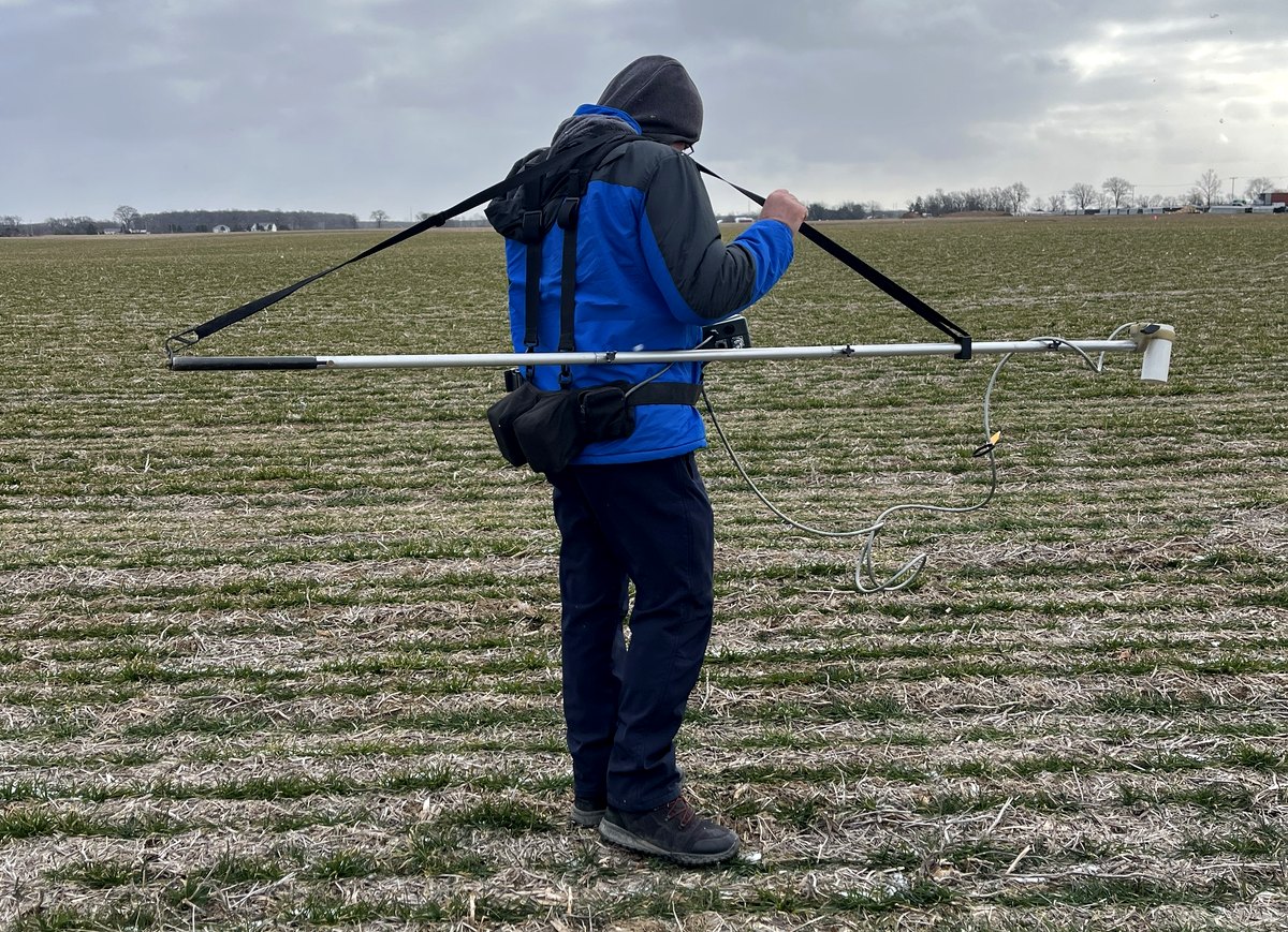
A solar development drives tens of thousands of piles. It does it fast, on open agricultural ground, across hundreds or thousands of acres, in states that have been drilled for oil and gas for over a century. Those two facts sit uncomfortably together and the industry has not fully reckoned with it yet.
Estimates of undocumented orphaned wells in the United States run from about 310,000 to 800,000. The range is that wide because nobody knows — which is the entire problem. A well that was recorded is a well somebody can avoid.
Why the records do not help
State registration of oil and gas wells is a twentieth-century invention. Pennsylvania's first commercial well was drilled in 1859; Ohio and West Virginia were producing in quantity before 1900. Mandatory recording, plugging standards and abandonment reporting arrived decades later, and were applied inconsistently for decades after that.
So the wells least likely to appear on a state map are also the ones most likely to be shallow, most numerous, and most likely to sit under farmland that is now attractive to a developer. Add wells recorded with a location derived from a quarter-section description, wells plugged before modern standards with whatever was to hand, and wells whose casing was cut off below plough depth and salvaged for scrap, and the record becomes a starting point rather than an answer.
What happens when a pile finds one
The best case is an expensive afternoon. The rig stops, the pile is damaged, the crew stands down, and somebody begins a conversation about what exactly is down there.
The worst case is that the pile opens a path into a formation that has been sealed, badly or well, for eighty years. That can mean a gas release at surface, a pathway between a hydrocarbon zone and shallow groundwater, a reportable incident, a regulator on site, and a remediation whose cost is unrelated to anything in the construction budget. The developer's name is on all of it.
Methane migration from improperly abandoned wells is well documented, and the liability does not expire quietly. A site that has been piled is also considerably harder and more expensive to investigate after the fact than one that has not.
Why a well is a good geophysical target
The thing that makes this tractable is that a well is a long steel tube standing vertically in the ground, and that is close to an ideal target for a magnetic survey.
Steel casing distorts the earth's magnetic field, and a vertical cylinder produces a characteristic, compact anomaly that a trained interpreter recognises. We survey with gradiometer arrays — two sensors at fixed vertical separation, measuring the difference rather than the absolute field — which suppresses the broad regional variation and the diurnal drift and leaves the local sources standing out. Positioned by RTK GNSS, on line spacing tight enough not to walk past a target, this covers large acreage at a rate that fits a development programme rather than obstructing it.
Where magnetics alone is not enough
Three situations degrade it, and an honest proposal says so before the survey rather than after.
The casing has been salvaged or corroded away. No steel, no magnetic anomaly. What may remain is disturbed ground, a cellar, or a plug.
The site is magnetically noisy. Agricultural ground accumulates iron — plough points, fencing, buried debris, old implements. On a noisy site the question stops being "is there an anomaly" and becomes "which of these two hundred anomalies is a well", and that is an interpretation problem rather than a detection problem.
Cultural infrastructure dominates. Existing collection lines, fencing, rail, pipelines and overhead power produce responses far larger than a well casing.
This is why we run EM61-class time-domain metal detection alongside the magnetics on any site where it matters. EM responds to conductive mass on a completely different physical basis and discriminates differently — and the combination separates a casing from a plough point far more reliably than either does alone. Two methods agreeing is evidence. One method is a hypothesis.
The economics are not close
A pre-construction well survey across a solar footprint is a small fraction of one percent of project cost. A single struck well is a stopped programme, an incident report, a remediation of unknown scope, and a line item nobody budgeted.
The timing matters as much as the survey. Done early, the output is a GIS layer the civil designer loads and lays the pile grid around — an avoided well costs nothing but a small adjustment to a layout that has not been fixed yet. Done after the layout is frozen, the same finding is a redesign. Done after piling has started, it is an incident.
What a good deliverable looks like
Not a map of every magnetic anomaly on the site. That is raw data wearing a title block, and it transfers the interpretation problem to the person least equipped to solve it.
What a developer can use is a ranked target list: every anomaly positioned to survey grade, classified, and ranked by how confidently it is a well casing rather than incidental iron — with the basis for each classification stated. High-confidence targets get avoided or investigated. Low-confidence targets get a documented decision. The ranking is the product; the anomaly map is the working.
And where a target has to be resolved rather than avoided, that is a conversation about a test hole, not another pass with the same instrument.
Abandoned
and orphaned well location — how we run it →
Magnetic surveys →