Home › Geophysical services › Electromagnetic surveys & TDEM
02 / Electromagnetic
Electromagnetic surveys & TDEM
Where radar stops, electromagnetics usually starts. Conductive ground defeats radar and is exactly what EM measures well — which is why the two methods so often run together.
What it measures
An EM instrument induces a current in the ground with a transmitter coil and measures the secondary field that current produces. The response is governed by electrical conductivity, which responds to clay content, moisture, dissolved salts, contamination and buried metal.
Because no contact with the ground is needed, EM is fast. A two-person crew can profile many acres in a day at a line spacing tight enough to resolve a landfill boundary or a plume front.
The four jobs it does best
- Bulk ground change. Fill against natural ground, made ground, former watercourses, the edge of a landfill cell — boundaries that are invisible at surface and obvious in conductivity.
- Buried metal. EM61-class time-domain metal detectors respond to ferrous and non-ferrous mass alike, and will find drums, tanks, ordnance and well casings that magnetics misses or that radar cannot reach.
- Plumes. Conductive contamination — leachate, brine, some industrial discharges — maps directly. Non-conductive product does not, and we will say so.
- Pipes and cables. Direct-connect and inductive locating of live and traceable services, which is a different instrument and a different discipline from profiling.
TDEM and VLF, for depth
Time-domain EM sounds far deeper than terrain conductivity meters by cutting the transmitter current and measuring the decay. It is the method for depth to a conductive layer, saline interfaces and deep structure where a resistivity line would be impractically long.
VLF uses distant military transmitters as its source and responds to steeply dipping conductive features — fracture zones, faults, and the water-filled fissures that feed deep voids. On the Antigua runway survey it was VLF that found the deep dissolution features the radar could not reach.
What it will not tell you
EM gives you conductivity, not identity. A strong anomaly is a change in the ground; deciding whether it is a tank, a trench of wet fill or a clay lens usually needs a second method over the same spot. It is also sensitive to cultural noise — fences, rails, overhead lines, reinforced slabs — and on a congested industrial site that can dominate the record.
Equipment and capability
- Terrain conductivity, EM31 / EM38 class
- Metal detection, EM61 class
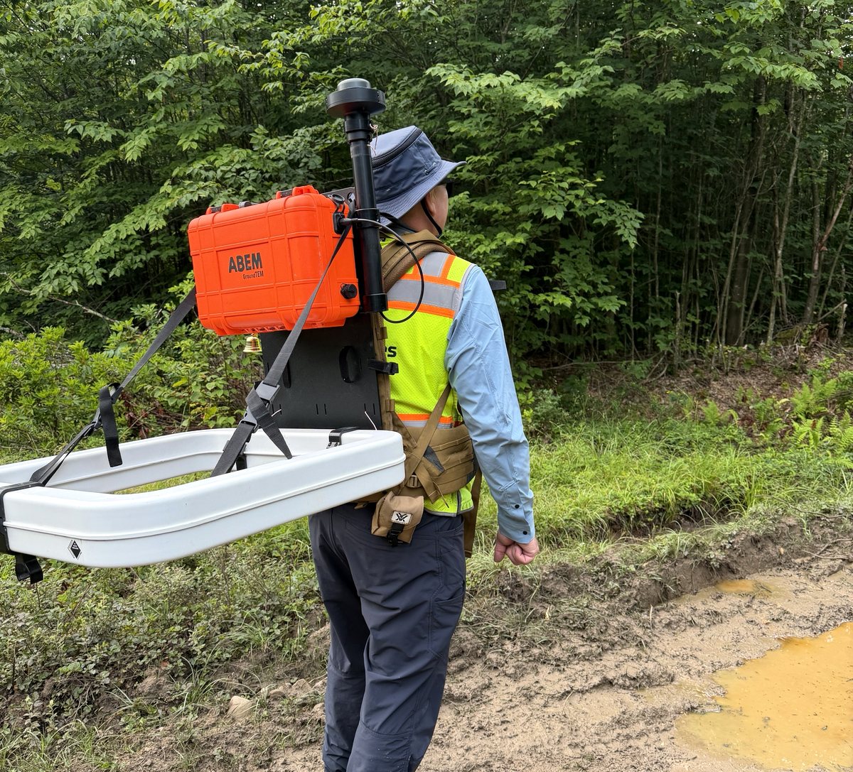
- TDEM for deep sounding — ABEM GroundTEM, backpack configuration
- VLF for deep voids and fracture zones
- Pipe and cable locating, direct connect and induction
- Frequency-domain profiling
What you receive
Gridded conductivity and in-phase maps over your site plan, anomalies ranked and numbered, with an interpretation that separates what is confidently identified from what is merely anomalous. Raw data supplied on request.
Ask before you commission
Tell us the target, the ground and the constraint and we will say whether this method answers it, whether it needs a second method alongside, or whether something else entirely is the better route. That conversation is free and it is usually short.