Gravity
The Gravity Method Is A Last Resort In Critical Situations
 The Gravity method is used by GeoSearches while working in difficult settings where other, more rapid and economical methods cannot be employed. It is an unobtrusive method capable of performing in environmentally sensitive areas such as inside buildings and parking garages. Most sites requiring gravity surveys, often as the only resort, involve mapping voids, underground wash-outs, sink holes and other cavities.
Gravity has been used successfully when nothing else worked to find old USTs that were abandoned prior to construction have had building foundations placed on top of them. To measure such small spatial differences in the gravitational pull of the earth, an extremely sensitive instrument, the Gravimeter, is required to detect gravitational anomalies less than one ten-millionth of the total gravitational field of the earth.
How Does Gravimeter Work?
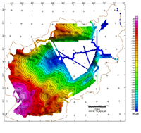
This instrument does not measure the absolute value of the pull of gravity, but measures spatial differences in the gravity pull - essentially relative gravity. If the gravity field over an air-filled void (i.e. cavern, tunnel or UST) is measured, and the void is close enough to the ground surface, then a decrease in the gravitational pull across the void will be measured. Anomalies, such as voids, and the distribution of subsurface materials are determined from gravity data using non linear least squares inversion of the data. The computed models are presented as contour maps.

