Ground Penetrating Radar
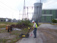
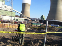
 Ground-penetrating radar (GPR) is a geophysical method that uses radar pulses to image the subsurface. This non-destructive method uses electromagnetic signals in the micro-wave band (UHF/VHF frequencies) of the radio spectrum, and detects the reflected signals from subsurface structures. GPR can be used in a variety of media, including rock, soil, ice, fresh water, pavements and structures. It can detect objects, changes in material, and voids and cracks.
GPR uses transmitting and receiving antennas or only one containing both functions. The transmitting antenna radiates short pulses of the high-frequency (usually polarized) radio waves into the ground. When the wave hits a buried object or a boundary with different dielectric constants, the receiving antenna records variations in the reflected return signal. The principles involved are similar to reflection seismology except that electromagnetic energy is used instead of acoustic energy, and reflections appear at boundaries with different dielectric constants instead of acoustic impedances.
 The depth range of GPR is limited by the electrical conductivity of the ground, the transmitted center frequency and the radiated power. As conductivity increases, the penetration depth also decreases. This is because the electromagnetic energy is more quickly dissipated into heat, causing a loss in signal strength at depth. Higher frequencies do not penetrate as far as lower frequencies, but give better resolution. Optimal depth penetration is achieved in ice where the depth of penetration can achieve several hundred meters. Good penetration is also achieved in dry sandy soils or massive dry materials such as granite, limestone, and concrete where the depth of penetration could be up to 15 m. In moist and/or clay-laden soils and soils with high electrical conductivity, penetration is sometimes only a few centimetres.
 Ground-penetrating radar antennas are generally in contact with the ground for the strongest signal strength; however, GPR air launched antennas can be used above the ground.
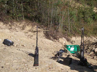
Cross borehole GPR has developed within the field of hydro-geophysics to be a valuable means of assessing the presence and amount of soil water.
Concrete Penetrating Radar
Provides concrete images on-the-spot in minutes, before cutting or drilling.
Applications
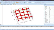
- Concrete inspection - locate metallic and non-metallic targets in walls,floors and ceilings
- Structure inspection - bridges, monuments, walls, towers, tunnels,balconies, garages, decks
- Condition assessment - map relative concrete condition for rehab planning
- Measure slab thickness
- Void location


